A LiDAR point cloud 3D model is the measurable digital replica of a site that a project team works from once a raw LiDAR scan has been cleaned and reconstructed, standing in for the real site in design, coordination, and analysis. The scan itself lands as a point cloud, millions of measured points that capture a site in millimeter detail but carry no structure on their own. The same meshing and tracing methods work on any point cloud, so what separates a LiDAR job is the state the data arrives in and the output it can support. Terrain becomes a mesh or DTM handled largely by software, while a building is traced by hand into parametric BIM objects, so LiDAR point clouds turn into the 3D building models teams schedule, coordinate, and clash-check from.
Reconstruction is rarely easy, because LiDAR arrives georeferenced in global coordinates, mixed with ground and vegetation, and uneven in density, so turning it into a model takes trained specialists rather than a one-click tool. Which output a project needs, how high an LOD the capture method allows, how far the work can be automated, and whether to outsource LiDAR to BIM decide what a team actually gets out of the scan.
What Is a LiDAR Point Cloud?
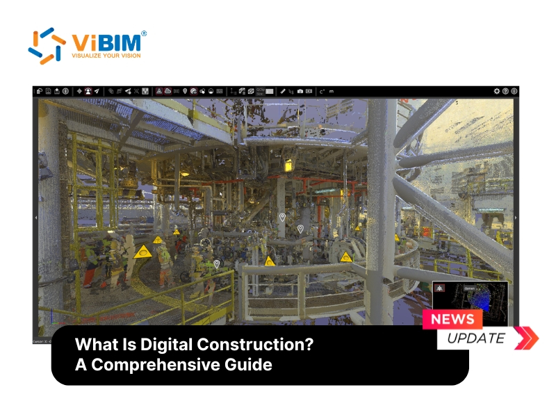
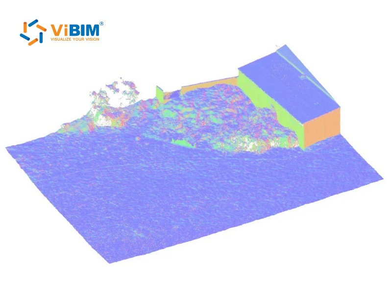
A LiDAR point cloud is a dense set of georeferenced X, Y, and Z points that a laser scanner records to capture the exact shape of a site or structure. Each point marks where a laser pulse hit a surface, and most points carry extra values on top of position, such as intensity, return number, and RGB color, that later help a modeler tell asphalt from grass or find the ground beneath a tree canopy.
A LiDAR point cloud is the raw material at the very start of the pipeline, not the model itself. You cannot run a volume check or a clash test on bare points, so the cloud has to go through 3D point cloud modeling to become a structured 3D model a team can build from. That raw cloud raises two questions worth settling first, whether LiDAR and a point cloud mean the same thing, and how the data gets captured in the first place.
Is LiDAR the Same as a Point Cloud?
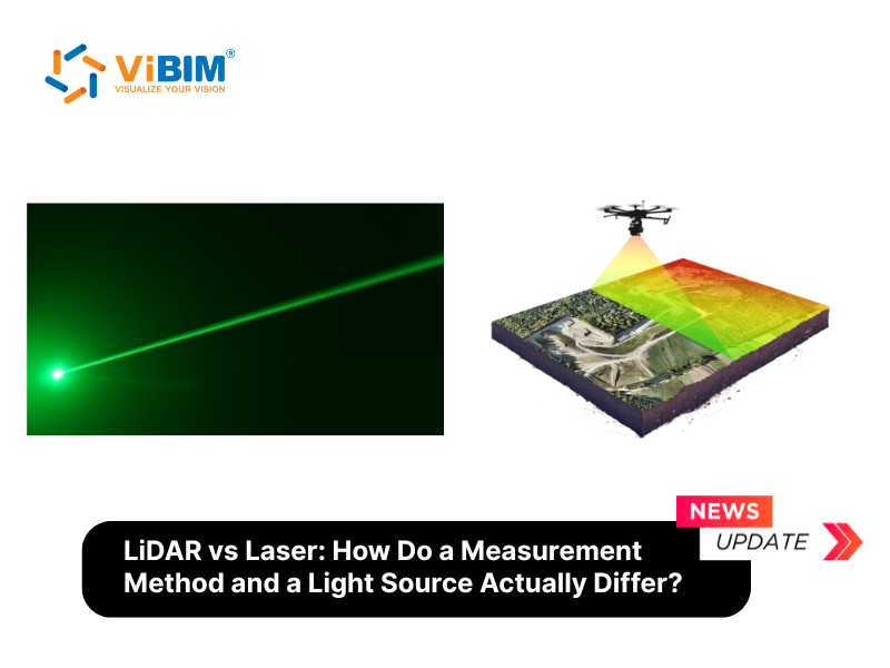
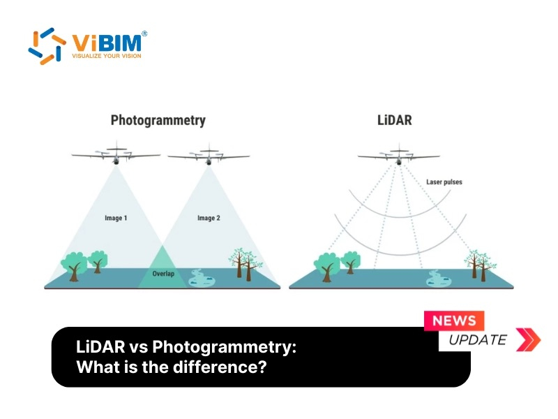
No, LiDAR and a point cloud are not the same thing, because LiDAR is the laser scanning method and the point cloud is the data that method produces. A LiDAR sensor fires pulses of light and times each reflection to measure distance, and the millions of measured points it returns are the point cloud. The same point cloud can also come from photogrammetry, which derives points from overlapping photos instead of a laser, so a point cloud is the output while LiDAR is one of the ways to capture it. That distinction also settles the common lidar vs laser terminology.
How Is LiDAR Data Captured?
LiDAR data comes from three capture families, airborne, terrestrial, and mobile, and each one produces a point cloud with different coverage, density, and accuracy. The capture method decides how detailed a model the data can support. The three families differ as follows:
- Airborne LiDAR: Flown on planes, helicopters, or drones, it covers large areas fast and suits terrain models and 3D city models, where broad coverage matters more than millimeter precision. Drone LiDAR sits at the detailed end and captures rooftops and construction sites at higher density.
- Terrestrial LiDAR: Tripod-mounted static scanning, the high-precision end used for building documentation and Scan to BIM. It is the standard where millimeter accuracy is needed for interiors, structure, and MEP, and it relies on the same 3D laser scanning that feeds most as-built work.
- Mobile LiDAR: Mounted on a vehicle or backpack, it records corridors quickly and is the go-to for roads, railways, and street-level infrastructure.
Whichever family delivers the cloud, turning it into a model follows the same two-stage path.
What Changes When the Input Is LiDAR
A LiDAR point cloud changes four things about a conversion job: airborne and mobile scans arrive already georeferenced in a global coordinate system, every LiDAR point cloud carries ground and vegetation returns that have to be separated before any surface is built, density varies across the site rather than staying even, and the data lands in formats written for LiDAR rather than for modeling software. The modeling steps themselves are not LiDAR-specific, so for the complete step-by-step method see how to convert point cloud into 3d model. What LiDAR decides is which of two outputs the data can support:
- Terrain and ground surfaces: Software wraps the ground returns into a mesh or DTM with little manual work, because terrain tolerates the uneven density that makes building elements hard to trace.
- Buildings and infrastructure: A modeler traces walls, structure, and MEP into parametric BIM objects by hand, because LiDAR classification separates ground from structure but never one building element from another.
Georeferencing, classification, and density each raise an obstacle of their own. The format the LiDAR point cloud arrives in decides what a modeler can open at all.
What File Formats Do LiDAR Point Clouds Use?
LiDAR point clouds are stored in the LAS format or its compressed LAZ form, exchanged as E57, and indexed by Autodesk ReCap into an RCP project that points at the individual RCS scan files before they enter Revit. The formats fall into three roles:
- LAS and LAZ: LAS is the LiDAR standard, carrying the classification code and return number each point needs, and LAZ stores that same data losslessly.
- E57: E57 is vendor-neutral, so a file moves between teams and instruments without conversion, and it is the usual choice when a project mixes LiDAR and photogrammetry.
- RCP and RCS: ReCap writes each scan to its own RCS file and links them from a single RCP project, so Revit can load millions of points without stalling.
For how each format compares and when to use it, see our guide to point cloud file formats. Once cleaned and loaded, the cloud becomes a model, most often a 3D building model.
LiDAR Point Cloud 3D Building Models
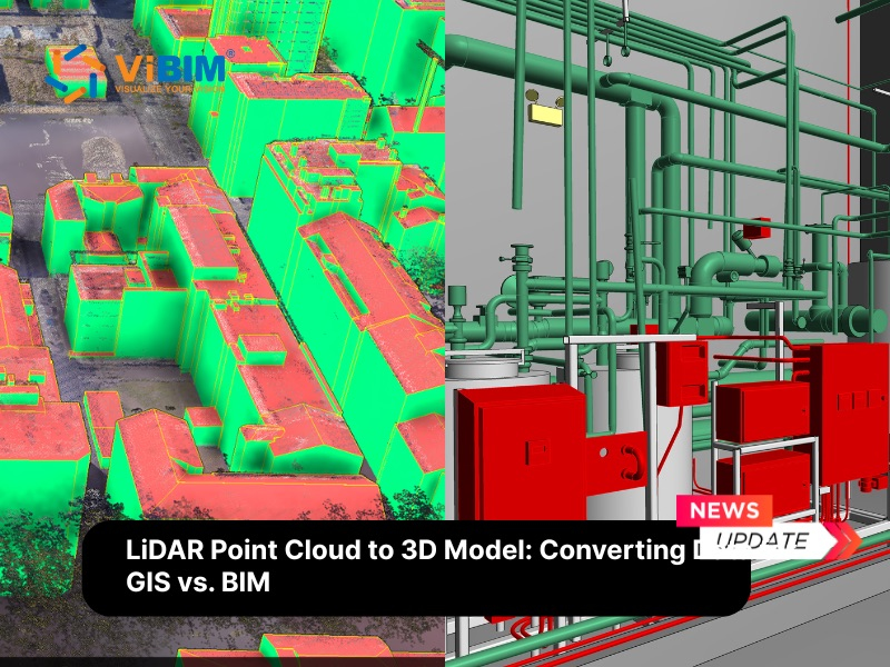
A LiDAR point cloud 3D building model is an intelligent BIM model in which every wall, column, beam, floor, and MEP run from the scan is rebuilt as a parametric object, held to a target LOD and georeferenced to the real site. A building model is the output most building and infrastructure projects are after. Unlike a 3D mesh model or a GIS surface, which record only the outer shape, a building model knows what each element is, so a wall carries its thickness and material and a duct carries its size and system.
That element-level intelligence is the payoff of point cloud to BIM modeling, and it lets a team schedule quantities, run clash detection, and coordinate trades directly from the model. How much detail these 3D building models reach is capped by the scan, since a terrestrial LiDAR cloud supports LOD 300 and above while a sparse airborne or mobile cloud tops out lower.
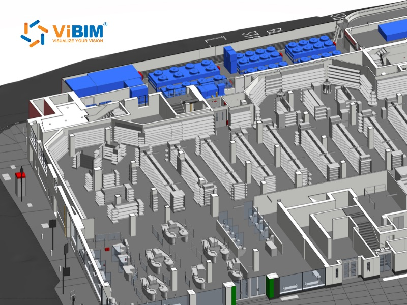
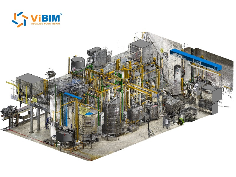
For teams that need that object-based deliverable without building the workflow in-house, ViBIM’s point cloud to BIM services turn the cleaned cloud into a checked model. The same approach scales to heavier assets, so an industrial plant becomes a model of individual pipes, tanks, and steel members rather than one outer shell.
What Else Can You Build from LiDAR?
Besides a BIM model, a LiDAR point cloud can become a GIS surface such as a DTM, a DSM, or a terrain mesh for landscape and infrastructure work. Which output a project needs depends on the goal, not the data alone, so choosing wrong wastes either detail or budget. The non-building outputs compare as follows:
| Output | Best for | Typical form | Main tools |
|---|---|---|---|
| GIS surface | Terrain, landscape, and infrastructure mapping | DTM, DSM, or a terrain mesh (TIN) | ArcGIS, QGIS |
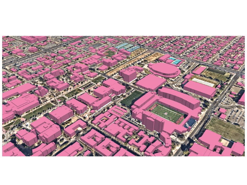
| City model | Urban planning, solar and flood analysis | Extruded building blocks on a basemap | ArcGIS, QGIS |
At city scale, building footprints from an airborne cloud are extruded into simple 3D building blocks over a basemap, which is how flood and solar studies get their geometry. Not every project needs a full model at all, and when the goal is only to measure terrain or the cloud is too sparse, the point cloud or a simple GIS surface is enough. For terrain and site work that does need a modeled surface, topography scan to BIM services turn the cloud into the DTMs and site models civil teams work from.
None of these outputs come easily, because LiDAR data fights back at every step.
Why Is LiDAR Data Hard to Turn into a 3D Model?
LiDAR data is hard to turn into a 3D model because the raw cloud arrives georeferenced, mixed with terrain and vegetation, and uneven in density, so it needs cleaning, classification, and skilled modeling before it becomes usable. Three obstacles cause most of the trouble, reconciling coordinate systems, separating structure from ground and vegetation, and matching point density to the detail the model needs.
Georeferencing and Coordinate Systems
Georeferencing decides whether a LiDAR model lines up with reality, because LiDAR arrives in a global coordinate system while a BIM model works in local project coordinates. Airborne and mobile clouds come tagged to real-world systems such as UTM or State Plane, so they can sit thousands of meters from a project origin. Before modeling, that global position has to be reconciled with the local coordinates the BIM model uses. When creating Revit model from point cloud data, any error in that step shifts the whole model off true.
Noise, Vegetation, and Classification
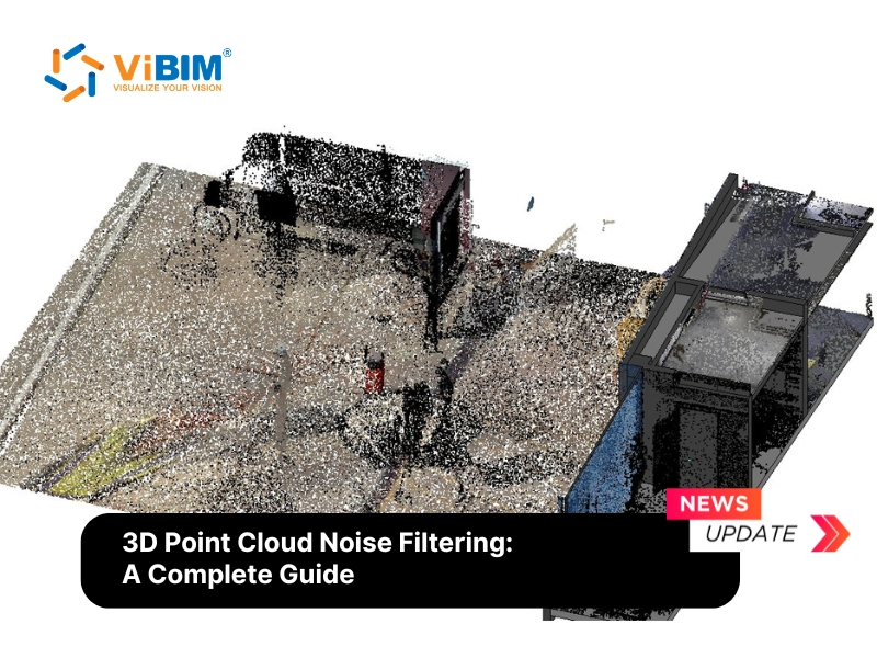
Point classification separates the ground, vegetation, and built structures inside a LiDAR cloud, and getting it wrong leaves noise that corrupts the final model. Airborne and mobile LiDAR sweep up a whole scene at once, so bare ground, tree canopy, and buildings all arrive in one undifferentiated cloud. Sorting them apart relies on point classification and on the return-number value each point carries, which is what lets a modeler find the ground beneath vegetation. That sorting, along with 3D point cloud noise filtering to clear stray returns, has to happen before anyone traces clean geometry, or the model inherits gaps and artifacts that are expensive to fix later.
Point Density and Achievable Detail
Point density sets the level of detail a LiDAR model can reach, because sparse or uneven coverage cannot support the fine geometry a high-detail model needs. Density changes with the capture method, so an airborne cloud that maps a whole district cannot resolve a window mullion the way a terrestrial scan can. The density has to match the intended model, because a sparse cloud cannot carry fine geometry, while an over-dense one has to be downsampled before it can be modeled at all. Clearing all three is exactly why point cloud to BIM modeling with LiDAR is skilled work rather than a batch job.
What Does LiDAR-to-BIM Modeling Involve?
LiDAR-to-BIM modeling involves working inside a ceiling the scan already set, because point density fixes how much detail a model can carry and the capture platform fixes the density. A survey team meets that limit after the LiDAR point cloud is collected, so an airborne or mobile cloud will not reach the LOD a terrestrial scan of the same building supports. The three capture families sit at different heights:
- Airborne LiDAR: Airborne data supports terrain, rooftops, and city-scale massing, because spreading a flight across a wide area leaves the fewest points on any single structure.
- Mobile LiDAR: Mobile data supports corridors and street-facing facades, because density falls off with distance from the vehicle path and interiors stay beyond a vehicle-mounted scan’s range.
- Terrestrial LiDAR: Terrestrial data supports interiors, structure, and MEP modeled to tolerance, because a tripod scanner records the same wall from meters away rather than from a moving platform.
Agreeing the LOD before the scan is booked therefore costs less than discovering the limit afterwards, and the element-by-element tracing itself belongs to the Scan to BIM workflow.
Can LiDAR to BIM Be Automated?
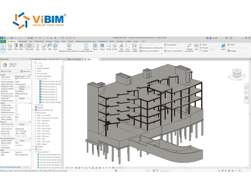
LiDAR to BIM can be automated only in part. Scripts handle registration, classification, and repetitive elements, but the irregular as-built geometry still needs a modeler’s judgment. Revit API and Dynamo routines speed up the repeatable steps, and machine learning helps sort points into classes, yet reading an ambiguous as-built condition and deciding how to model it stays a human job. Choosing scan to BIM software therefore means judging which stages it assists, not expecting one-click modeling.
When Should You Outsource LiDAR to BIM Modeling?
You should outsource LiDAR to BIM modeling when the LiDAR point cloud comes from an airborne or mobile platform, when the deliverable needs a high LOD, or when the job is one-off, because work at that level needs discipline modelers most survey firms do not employ. A survey team that owns the scanner rarely employs a Revit modeler as well, and a provider of Revit modeling outsourcing services takes the job from raw LiDAR to a delivered model.

Photogrammetry is the main alternative for capturing the same site, and it records the surface a different way.
How Does LiDAR Compare to Photogrammetry?
LiDAR and photogrammetry both produce a point cloud, but LiDAR measures distance with a laser while photogrammetry derives it from overlapping photos, so the two differ in accuracy, cost, and how they handle vegetation. LiDAR measures geometry directly and can find the ground through a tree canopy using multiple returns, which photogrammetry cannot, while photogrammetry needs less hardware and captures color and texture better. For a full breakdown of which method fits which project, see our guide to LiDAR vs photogrammetry. Whichever method captures the cloud, it still arrives as raw points that have to be modeled before anyone can build from them, which is where a LiDAR point cloud to 3D model workflow pays off.