Processing and transferring massive point cloud datasets, often exceeding hundreds of gigabytes, is a primary challenge in modern Architecture, Engineering, and Construction (AEC) projects. Generated from technologies like laser scanning and photogrammetry, these datasets are the foundation for creating precise Scan to BIM, but their sheer size and complexity can strain IT infrastructure and disrupt project timelines. This guide provides actionable strategies for efficient point cloud process and transfer, covering the core challenges, best practices in data handling, and the most effective methods for data exchange, including direct integration into Revit and other BIM workflows.

Challenges of Managing Large Point Cloud Datasets
Before implementing solutions, it’s crucial to understand the specific hurdles that massive point cloud datasets present, especially within the AEC industry. These challenges go beyond just file size and impact everything from project budgets to team collaboration.
Data Volume
The most immediate challenge is the immense volume of data. A single laser scan of a large building or infrastructure asset can generate terabytes of raw data. This creates significant bottlenecks for storage, processing, and transfer. Storing this data requires robust, high-capacity infrastructure, while transferring it between stakeholders can take hours or even days over standard internet connections, severely hampering productivity for globally distributed teams and creating significant latency issues.
Data Integrity
Maintaining the accuracy and integrity of point cloud data throughout its lifecycle is paramount. During transfer, files can become corrupted. Without proper versioning and access control, team members might work from outdated or incorrect models, leading to costly rework. Furthermore, ensuring that the data remains unaltered and secure is a critical concern, especially on projects with sensitive information.
Computational Power and Resources
Processing massive point cloud datasets is computationally intensive. Tasks such as registration (stitching multiple scans together), cleaning (removing noise), and feature extraction demand high-performance workstations with significant RAM, powerful GPUs, and fast storage. A lack of adequate computational resources can lead to slow performance, software crashes, and an inability to work with the full dataset, forcing teams to rely on less accurate, decimated versions. This also presents a barrier to integrating advanced technologies like AI and machine learning for automated analysis, as these processes require even greater computational power.

Best Practices for Processing Large Point Cloud Datasets
Effectively processing point cloud data requires a strategic approach that begins the moment data is captured and extends through the entire project lifecycle.
Using Specialized Software
Managing large point cloud datasets requires specialized software designed for efficient data processing and accurate point cloud generation. Platforms like Autodesk ReCap, Trimble RealWorks, and Leica Cyclone are designed to register, clean, and index raw scan data into more manageable formats (like .RCP or .RCS for the Autodesk ecosystem). These applications are optimized to handle billions of points, providing the technical foundation necessary for high-quality point cloud building modeling that accurately reflects site conditions.

Data Segmentation and Classification
Instead of working with a single monolithic file, break down the dataset into smaller, logical segments. This can be done by floor, building zone, discipline (e.g., structural, MEP), or construction phase. This point cloud segmentation makes the data lighter and easier to handle for individual team members. Furthermore, classifying points—tagging them as “floor,” “wall,” “pipe,” or “conduit”—adds intelligence to the model, making it easier to isolate specific systems for analysis and modeling in BIM platforms like Revit.

Point Cloud Registration Techniques
Strategic point cloud registration techniques play a vital role in processing massive point cloud datasets by bringing together scans collected from different positions or devices into one unified dataset. This process ensures that fragmented data is accurately aligned, forming a complete and reliable 3D representation of real-world environments.
Without reliable registration, even the most advanced storage, transfer, or compression strategies cannot guarantee that the dataset is meaningful or usable. In this way, registration serves as a bridge between raw data acquisition and higher-level management practices, making it a critical step in the overall lifecycle of massive point cloud datasets.
Data Compression Techniques
Data compression is a critical practice for processing large point cloud datasets efficiently, as it reduces file size without compromising accuracy. Formats such as LAZ (a compressed version of LAS) or E57, both widely supported across industry software, are commonly used to optimize storage, accelerate data transfer, and streamline processing workflows.
In practical workflows, especially during project coordination, teams often need to split oversized point cloud files into smaller segments or apply truncation and archiving (e.g., ZIP/RAR) to facilitate transfer when the original format must be preserved. These methods ensure that even when working with terabyte-scale datasets, files can be exchanged reliably over limited-bandwidth networks or delivered in compliance with client-specific format requirements.
Data Integrity and Quality Control
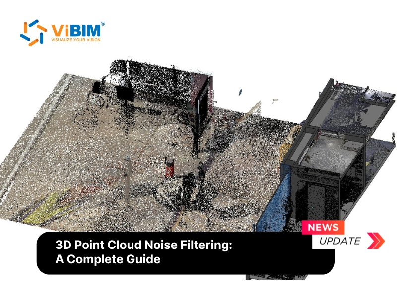
Maintaining data integrity throughout the entire lifecycle of point cloud management is essential to producing accurate 3D models. Noise, redundant points, and irrelevant data can reduce the overall quality of the dataset, making it difficult to extract reliable measurements. To address this, ensuring the accurate creation of point clouds is a key principle of quality control.
Common methods include denoising, outlier detection, and filtering techniques, all of which enhance point cloud quality for more precise and dependable results. For projects dealing with laser scan data from complex environments—such as industrial facilities or aging structures—applying specialized 3d point cloud noise filtering workflows before modeling can reduce rework by a significant margin and produce cleaner geometry in the final BIM deliverable.”
Point-Cloud Data Exchange Methods
Once the data is processed and managed, it needs to be shared among stakeholders. Choosing the right exchange method is critical to maintaining project momentum.
Method 1: Cloud-Based Data Exchange
Cloud-based platforms, including both general storage systems like Google Drive or Dropbox and specialized AEC Common Data Environments (CDEs) like Autodesk Docs and Trimble Connect, offer a powerful solution for managing and sharing point cloud datasets without massive upfront hardware investment.
Pros
- Accessibility: As long as there is an internet connection, team members can access project data from anywhere in the world. This is crucial for global teams and stakeholders, enabling seamless access to the latest point cloud models regardless of physical location.
- Collaboration: These platforms are built for teamwork. They allow multiple users to access, review, and sometimes even edit datasets concurrently. Features like version control, commenting, and issue tracking are often integrated, streamlining communication and reducing errors.
- Security and Access Control: Data security is critical for sensitive project information. Reputable cloud platforms employ robust security measures, including encryption and granular access controls, to protect datasets from unauthorized access or data breaches.
Cons
- Bandwidth Limitations: The primary drawback is the reliance on internet speed. Uploading and downloading multi-gigabyte or terabyte-sized point cloud files can be extremely time-consuming, creating significant project delays, especially for teams with slower internet connections.
- Cost: While many platforms offer entry-level or free tiers, the storage required for massive point cloud datasets often necessitates enterprise-level subscriptions. These recurring costs can become a significant operational expense over the life of a project.
- Dependence on Internet Connection: Managing large point cloud datasets in the cloud requires stable and reliable internet connectivity. Any disruption or downtime can interrupt workflows, delay collaboration, and slow down project delivery. Moreover, if the connection is lost while data is uploading or downloading, the process often has to restart from the beginning, wasting valuable time. This dependency on international bandwidth also introduces uncontrollable risks, as outages or instability in global network routes can directly impact project schedules and data availability.
- Data Privacy Concerns: When sensitive, building-related point cloud data is stored on cloud platforms, privacy and security become critical issues. Protecting this data from unauthorized access is essential to maintaining trust and ensuring compliance with industry standards.

Method 2: File-Based Data Exchange
This traditional method involves transferring files directly, either by shipping physical media like external hard drives or using direct online transfer protocols like FTP (File Transfer Protocol). It serves as a straightforward way to move large data volumes from one point to another.
Pros
- Internet Independence (with Hard Drives): Shipping a physical hard drive is completely independent of internet connection speeds. For multi-terabyte datasets, this can be significantly faster and more reliable than an online transfer.
- Low Cost (with FTP): Setting up and using an FTP server can be more cost-effective than paying for monthly or annual cloud storage subscriptions, especially for organizations that have existing server infrastructure.
- Resume Capability (with FTP): A key advantage of many FTP clients is the ability to resume transfers that have been interrupted. If a connection drops during a large file upload, the process can often be picked up where it left off, which is a feature not always available on standard cloud web interfaces.
Cons
- Physical Risk: Physical hard drives are susceptible to being lost, stolen, or damaged during transit. This can lead to complete data loss and significant project delays, as well as potential security breaches if the data is not encrypted.
- Slow and Insecure (with FTP): Standard FTP is often slow for massive files and, more importantly, lacks the end-to-end encryption that is standard on modern cloud platforms. This makes it a less secure option for transferring sensitive project data.
- Lack of Collaboration: This method is purely for data transfer. It offers no features for real-time collaboration, version control, or integrated communication, making it difficult to manage updates and track changes across a project team.
Method 3: Local Server Infrastructure Setup
Network-attached storage (NAS) systems from brands like Synology or QNAP, configured in a RAID 6 array with at least 10TB capacity per team member, deliver the high-speed access needed for active projects with frequent point cloud modifications. When paired with a 10-gigabit Ethernet network, this setup can handle simultaneous point cloud dataset transfers without causing workflow interruptions. For processing-intensive tasks like noise filtering and classification algorithms, dedicated workstations equipped with NVMe SSD arrays are essential. While this approach offers unparalleled speed and data control, it is limited to a single physical location and requires a significant upfront investment in both hardware and ongoing IT management.
Method 4: Hybrid Storage Strategies
Integrate high-performance local SSDs for ongoing projects with cloud storage archives for finalized datasets to balance speed and cost efficiency. Active point clouds remain on local drives for immediate access, while processed outputs are automatically synchronized to cloud repositories. Set up automated backup routines that transfer compressed point cloud files during off-peak hours, ensuring redundancy without disrupting daily mapping workflows. This hybrid strategy cuts local storage demands by 60% while preserving instant availability of active project files.
Choosing the right data exchange method is crucial, but successful collaboration also depends on finding the right partners—discover how to outsource Revit modeling to learn which providers have the infrastructure, security protocols, and file transfer capabilities to handle your point cloud datasets efficiently, whether you choose cloud-based, FTP, or hybrid exchange methods.
How to Ensure the Highest Accuracy When Converting Point Cloud to BIM?
Ensuring the highest accuracy during the conversion into a high-fidelity point cloud to BIM model requires a combination of expert knowledge and a rigorous quality control framework. At ViBIM, accuracy is maintained through a specialized two-layer independent quality check (QC) process that verifies technical geometry, adherence to modeling standards, and precise deviation checks against the original scan data. Our production team, consisting of qualified architects and civil engineers, utilizes advanced automation tools and proprietary custom-developed QA/QC solutions to ensure data consistency. This systematic approach guarantees that every BIM model meets the highest international standards of accuracy and reliability, providing a dependable foundation for any AEC project.
Outstanding USPs of ViBIM’s point cloud to BIM service:
- Exceptional Reliability: We maintain a 99% on-time delivery record, reflecting our commitment to professional project schedules.
- Fast Turnaround Time: Optimized workflows and advanced technology allow us to deliver results up to 30% faster than industry standards.
- High Accuracy & Reliability: Quality is ensured through meticulous checks at every project stage to meet US and UK industry standards.
- Responsive Communication: Your inquiries are prioritized with a commitment to respond in under one hour during business hours.
- Scalability and Expertise: With a dedicated team of over 30 professionals, we have the infrastructure to handle large-scale and complex modeling tasks efficiently.
ViBIM – Revit Modeling Outsourcing
- Address: 10th floor, CIT Building, No 6, Alley 15, Duy Tan street, Cau Giay ward, Hanoi, Vietnam
- Phone: +84 944 798 298
- Email: info@vibim.com.vn
FAQs
What file formats are best for storing point cloud data?
The best file formats for storing point cloud data are E57, LAS/LAZ, and proprietary formats like RCP/RCS. E57 is vendor-neutral and can store both point data and metadata. LAS is the standard for LiDAR data, with LAZ being its highly effective compressed version. For integration within specific ecosystems, proprietary formats like Autodesk’s RCP/RCS are optimized for performance in applications like Revit and Navisworks.
What storage solutions work best for massive point cloud files?
The best storage solutions for massive point cloud files are cloud object storage services such as Amazon S3 and Google Cloud Storage. These platforms provide scalability and accessibility, and are often combined with on-premise options like Network Attached Storage (NAS) or high-capacity hard drives for local access.
Which compression techniques reduce point cloud file sizes most effectively?
LAZ compression (lossless), voxel-based downsampling, intelligent decimation, and standard Zip/Gzip archiving are the most effective techniques for reducing point cloud file sizes.
What software tools are recommended for point cloud processing?
The recommended software for point cloud management includes both general and specialized tools such as CloudCompare ( used for point cloud manipulation and analysis. For more advanced needs) or specialized platforms such as Autodesk ReCap and Leica Cyclone (offer powerful capabilities for processing, registration, and precise editing).
Effectively managing massive point cloud datasets requires a strategic approach that combines specialized software, smart data segmentation, and efficient transfer methods. This approach ensures data integrity for creating accurate as-built BIM models.