A point cloud file format is a standardized digital structure for storing the vast collections of three-dimensional coordinate data generated by 3D scanners like LiDAR. In the Scan to BIM process, selecting the right format is a critical decision that directly impacts software compatibility, data exchange efficiency, and long-term project viability.
This article will analyze their core differences, take a deep dive into the specific strengths of RCP/RCS, LAS/LAZ, E57, PTS and PTX. We also provide a clear framework for selecting the right format for your project’s specific needs.
The 5 Primary Point Cloud File Formats
This section provides a comprehensive overview of the five primary file types including RCP/RCS, LAS/LAZ, E57, PTS, PTX. Understanding the distinctions between these formats is the first step in building an efficient and reliable reality capture workflow.
RCP / RCS: The Autodesk Proprietary Formats
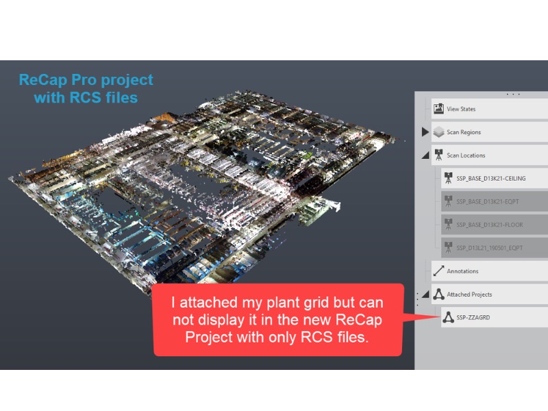
Proprietary formats are developed by a specific software company to optimize performance within its ecosystem. The most prominent examples in the AEC and BIM world are Autodesk’s RCP and RCS formats. These formats are not interchangeable with open standards but are engineered for a specific purpose. An RCS (ReCap Scan) file contains the indexed raw point cloud data from a single scan. An RCP (ReCap Project) file acts as a container, a project file that aggregates and manages multiple RCS scan files, along with their registration and coordinate system information.
The chain of reason for their widespread use within Autodesk-centric workflows is performance. These formats use a sophisticated spatial indexing system that allows software like Revit, AutoCAD, and Navisworks to handle and render massive point cloud datasets with remarkable speed and fluidity. By pre-processing the data into an optimized structure, the software can quickly load only the points needed for a given view, rather than holding the entire dataset in memory.
Their purpose is clear: they are optimized for maximum performance and seamless integration within a specific vendor’s software suite.
LAS & LAZ: The Standard for Aerial & Terrestrial LiDAR
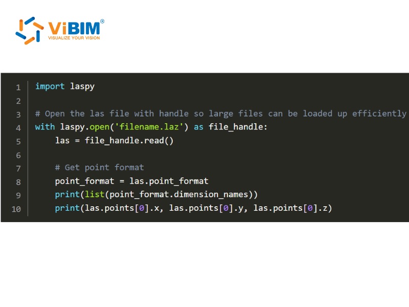
The LAS (LASer) file format is the industry-standard binary format for storing 3D point cloud data. Developed and maintained by the American Society for Photogrammetry and Remote Sensing (ASPRS), it was created to establish a universal standard for exchanging and archiving LiDAR data. Its compressed counterpart, LAZ, uses a lossless compression algorithm that can significantly reduce file sizes, making it ideal for storage and transfer without sacrificing any data.
The power of the LAS format lies in its structured binary nature. Each file contains a header block with comprehensive metadata about the survey—such as data extents, flight date, and coordinate system information—followed by individual records for each laser pulse captured.
The LAS format is highly structured and rich with essential metadata, defined by several key attributes:
- Comprehensive Metadata Header: Each LAS file begins with a header block that contains critical information about the entire survey, including data extents, flight date, point count, and the coordinate reference system used.
- Rich Per-Point Attributes: Beyond basic coordinates, every single point can store a wealth of specific information, such as GPS time, intensity, echo number (e.g., first return, last return), scan angle, and RGB color values.
- Standardized Point Classification: Each point can be assigned a pre-defined classification code (e.g., Class 2 for Ground, Class 5 for High Vegetation, Class 6 for Building), allowing for powerful automated filtering and feature extraction during processing.
- Extensibility: The format allows for custom data fields through Variable Length Records (VLRs), enabling users to add specialized information not covered by the standard specification.
Because the LAS format is designed to handle massive datasets from large geographical areas, such as those from aerial and drone-based LiDAR, the files can become exceptionally large. Consequently, visualizing and processing these files can be demanding on typical computers, and using a system with a dedicated GPU is often recommended for a smoother experience. A common strategy for managing this data is to break down a large file into smaller, more manageable tiles or sectors
For these reasons, LAS/LAZ is most widely used formats for airborne LiDAR deliverables and a common standard in terrestrial scanning
E57: The Archival & Interoperability Standard
The E57 file format is a vendor-neutral standard designed for the storage and exchange of 3D imaging data, including point clouds and associated imagery. Standardized by ASTM International under the E2807 standard, its core purpose is to solve the challenge of long-term data archival and interoperability between different scanning hardware and software platforms.
E57 files are capable of merging multiple types of data into one independent file. This can contain not just the raw point cloud (with coordinates, intensity, and color), but also the high-resolution panoramic imagery captured by the scanner and all the critical metadata that provides context, such as scanner positions, timestamps, and calibration data. The format uses a hybrid structure: metadata and organization described in XML, while large data blocks (point clouds, images) are stored in binary, which makes the data both human-readable at a high level and machine-readable, ensuring its robustness and future-proof accessibility.
For these reasons, the E57 format is the best choice for data exchange between different software platforms and for long-term project archiving.

PTS: A Simple, Widely-Compatible ASCII Format
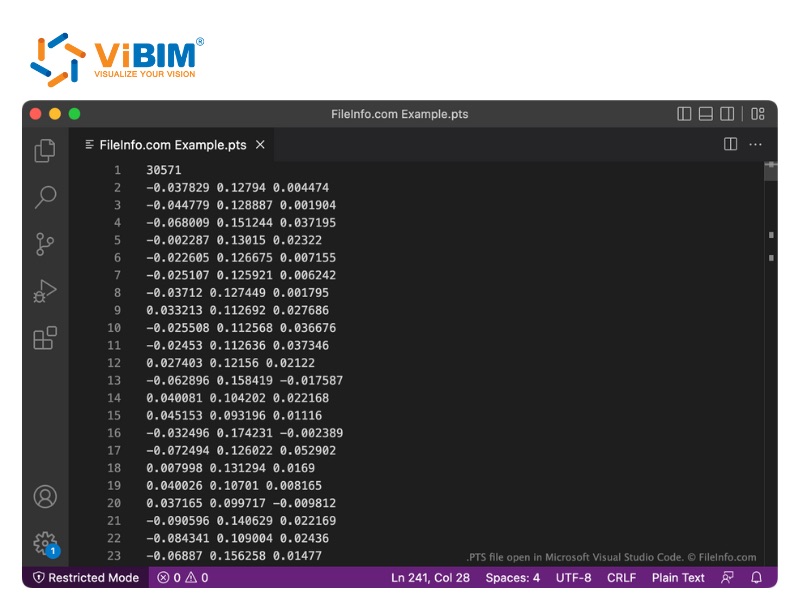
PTS is a commonly used format, especially for simple point cloud exchanges or when interoperability is required. A typical PTS file begins with a header line that indicates the total number of points, followed by individual lines for each point. Each point is usually represented by 3 to 7 columns, primarily containing the x, y, and z coordinates of points, but can also include intensity values and RGB color information depending on the scanner or export settings.
Because of its straightforward, non-proprietary structure, PTS is widely supported by many different 3D software applications, making it a reliable choice for basic data exchange when advanced features are not required. However, like other ASCII-based formats, PTS files can become extremely large and are less efficient to process than binary alternatives like LAS or E57.
For this reason, it is a common format for basic, unstructured data exchange due to its simplicity and broad software support, ideal when only the point coordinates are needed.
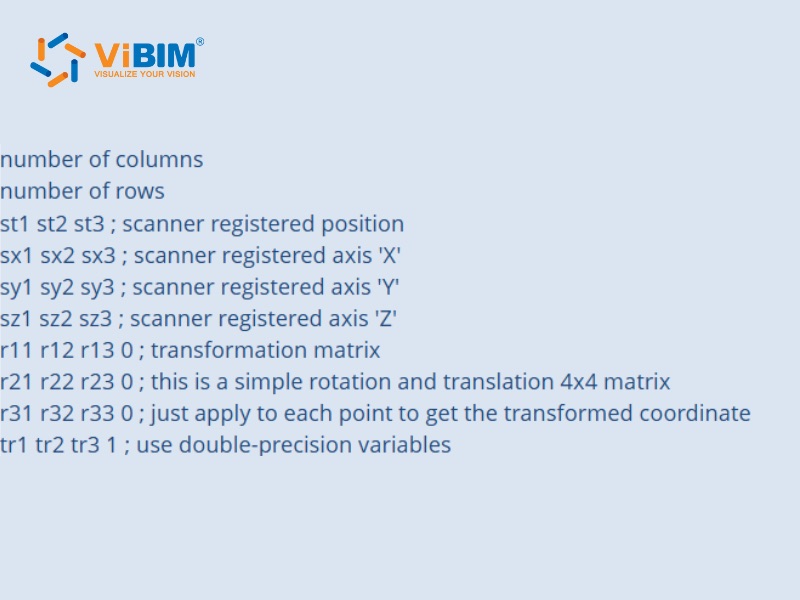
PTX: The Terrestrial Scanner Exchange Format
The PTX format commonly used as an export format from terrestrial laser scanners, especially from vendors like Leica. It is a more structured exchange format than PTS, as it organizes points based on their original scan positions. The file contains a header with information about each scan, including the scanner’s transformation matrix (its precise position and orientation), followed by the list of points for that scan.
This scan-centric structure makes it particularly useful for workflows that involve registering, or aligning, multiple scans together. By preserving the scanner’s origin for each dataset, it simplifies the process of combining individual setups into a cohesive project. While it offers more structure than a simple XYZ file, it still suffers from the large file sizes and slower processing speeds inherent to ASCII formats.
Due to its scan-based organization, PTX is an effective format for transferring individual scan data along with scanner poses, whether pre-aligned or for downstream registration
What Are the Core Differences in Point Cloud Formats?
While all point cloud formats store 3D coordinate data, they are not interchangeable. For the Scan-to-BIM professional, the critical differences lie in their underlying data structure, metadata capabilities, and intended use case, which together determine their performance, interoperability, and fitness for a given task. A format optimized for raw data acquisition from a drone is fundamentally different from one designed for long-term archival or high-speed performance within a specific modeling software.
The following table breaks down the key distinctions between the most common formats in the AEC industry to clarify their distinct roles within a project lifecycle.
| Characteristic | LAS / LAZ | E57 | RCP / RCS | Simple ASCII ( PTS,…) |
| Primary Use Case | Raw data delivery from aerial & terrestrial LiDAR surveys. | Vendor-neutral data exchange and long-term project archiving. | High-performance modeling and visualization within the Autodesk ecosystem. | Academic use, simple scripting, and basic data transfer. |
| Data Structure | Structured Binary | Structured Binary with an XML-based hierarchy. | Proprietary, Indexed Binary | Unstructured Text (ASCII) |
| Compression | Uncompressed (LAS) or industry-standard lossless (LAZ). | Uses internal binary compression for point data. | Optimized proprietary compression. | None; uncompressed text. |
| Metadata Support | Excellent: Standardized for classification codes, CRS, GPS time, and scan parameters. | Superior: Designed to bundle point data, high-resolution imagery, and scanner metadata in one file. | Good: Manages scan locations, registration, and project structure effectively. | Minimal: No standardized metadata support. |
| Interoperability | High: As an open industry standard, it is widely supported. | Highest: Specifically designed as a vendor-neutral format for maximum compatibility. | Low: Intended for use only within Autodesk software. | High: Simple structure is readable by most software but lacks crucial context. |
| Scan to BIM Fitness | Excellent for receiving, processing, and classifying the initial survey data. | Excellent for delivering a complete, unadulterated dataset to a client or collaborator. | Excellent for direct, high-performance use during the modeling phase in Revit or AutoCAD. | Poor for professional projects due to massive file sizes and slow performance. |
This comparison highlights a clear divide in functionality. Simple ASCII formats like XYZ and PTS are too inefficient for the scale of modern Scan to BIM projects. The professional’s choice is a strategic one, typically between LAS/LAZ for robust data acquisition and classification, E57 for delivering a complete and universally accessible project archive, and RCP/RCS for achieving the smoothest performance once the data is brought into Autodesk software for the final modeling phase.
How to Choose the Right Point Cloud File Format
Selecting the best format for your project depends entirely on your specific goals and workflow. To make the right choice, ask yourself these four key questions:
- What is my primary application? If you’re working with airborne or terrestrial LiDAR survey data, LAS/LAZ is the industry standard. For creating as-built documentation and BIM models from terrestrial scans, E57 and RCP/RCS are the strongest contenders.
- What software will I be using? If your entire workflow is within the Autodesk ecosystem (Revit, AutoCAD, etc.), using RCP/RCS will provide the most streamlined and high-performance experience. If you are using open-source tools like CloudCompare or PDAL, open formats like LAS, LAZ, or E57 are essential.
- Do I need to exchange data with collaborators? When you need to deliver a project to a client or partner and you don’t know what software they use, the vendor-neutral E57 format is the safest and most complete option, ensuring maximum compatibility.
- Is long-term archival a requirement? If you need to preserve a complete and unalterable record of a 3D scanning project for future use, the E57 format is explicitly designed for this purpose and is the undisputed best choice.
See more: Best point cloud to bim software for your project
FAQs
What file format does Autodesk use?
Autodesk primarily uses its proprietary RCP (Reality Capture Project) and RCS (Reality Capture Scan) file formats. These are created by Autodesk ReCap and are optimized for high-speed performance within software like Revit, AutoCAD, and Navisworks.
Can I convert between point cloud file formats?
Yes, conversion between formats is a common task. Free, open-source software like CloudCompare is a powerful and popular tool for converting between most formats (e.g., E57 to LAS). However, be aware that converting from a rich format to a simpler one may result in data loss. For example, converting an E57 file (which contains panoramic images) to a LAS file will discard the imagery, as the LAS format does not support it.
Can you open a RCP file in AutoCAD?
Yes, you can. RCP files are the standard way to bring point clouds into AutoCAD and other Autodesk products. You can attach an RCP file to your drawing as an external reference, allowing you to view, navigate, and snap to the point cloud data as a basis for your 2D or 3D modeling work.
Navigating the world of point cloud file formats can seem complex, but as we have seen, each format serves a distinct and vital purpose within the reality capture ecosystem. From the universally mandated LAS for LiDAR surveys and the robust archival power of E57, to the high-performance proprietary nature of RCP/RCS, the key takeaway is that format selection is a strategic decision, not a technical afterthought.
At ViBIM, we handle these complex data challenges every day, turning massive point clouds into actionable BIM models. If you’re looking to leverage the power of point cloud data for your next project, our team of experts is ready to help you choose the right formats and build the right workflow. Contact us today to learn more.